.png)

Aspen Acres Fire Update July 26, 2026: Fire Grows to 101,879 Acres, 61% Contained as All Evacuations Reduced
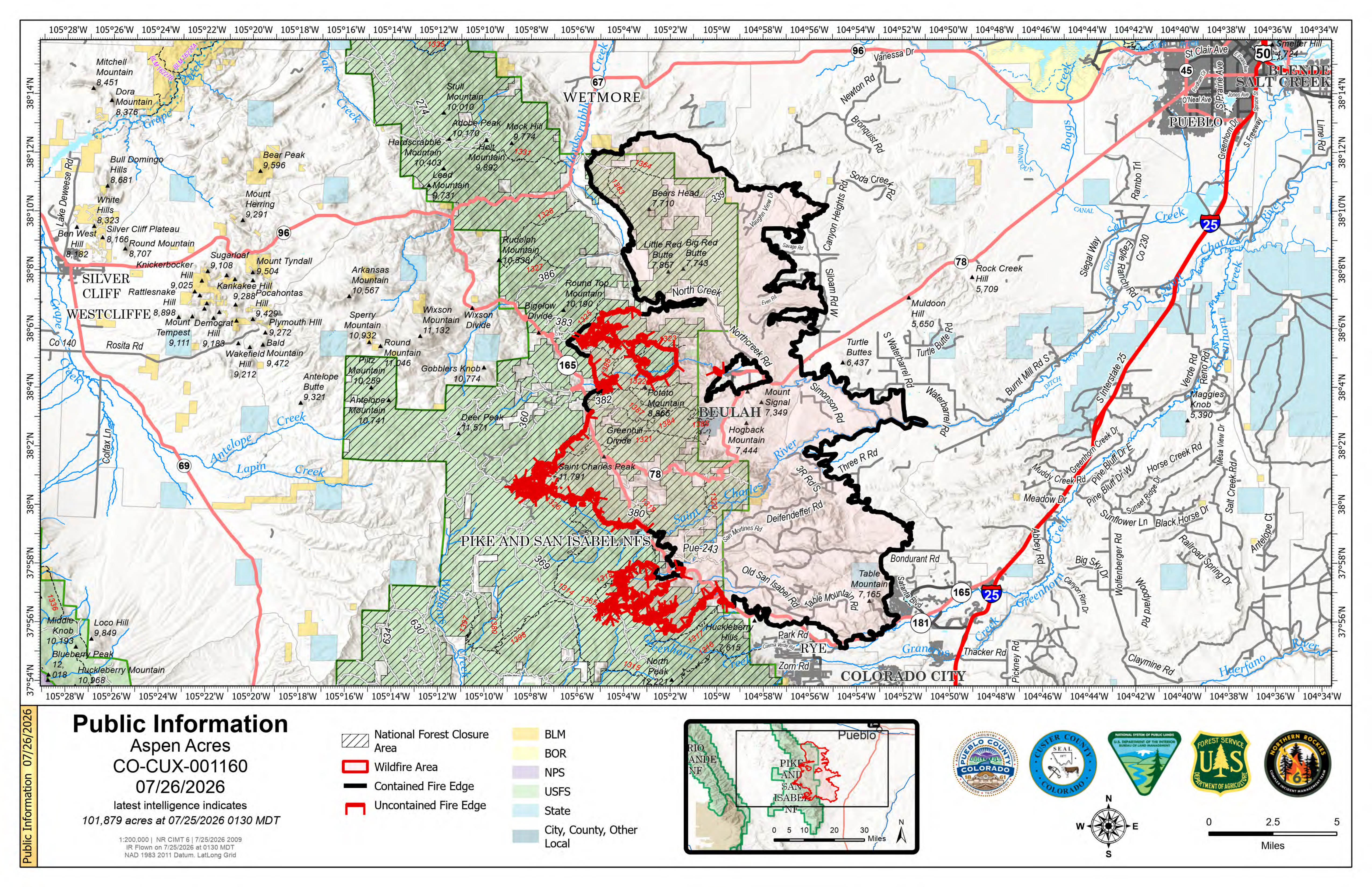
Description: The Aspen Acres Fire near Rye, Colorado is now 101,879 acres and 61% contained. All evacuation zones have been reduced to pre-evacuation or clear status as firefighters continue suppression, repair work, and prepare for thunderstorms and new lightning-caused fire starts...
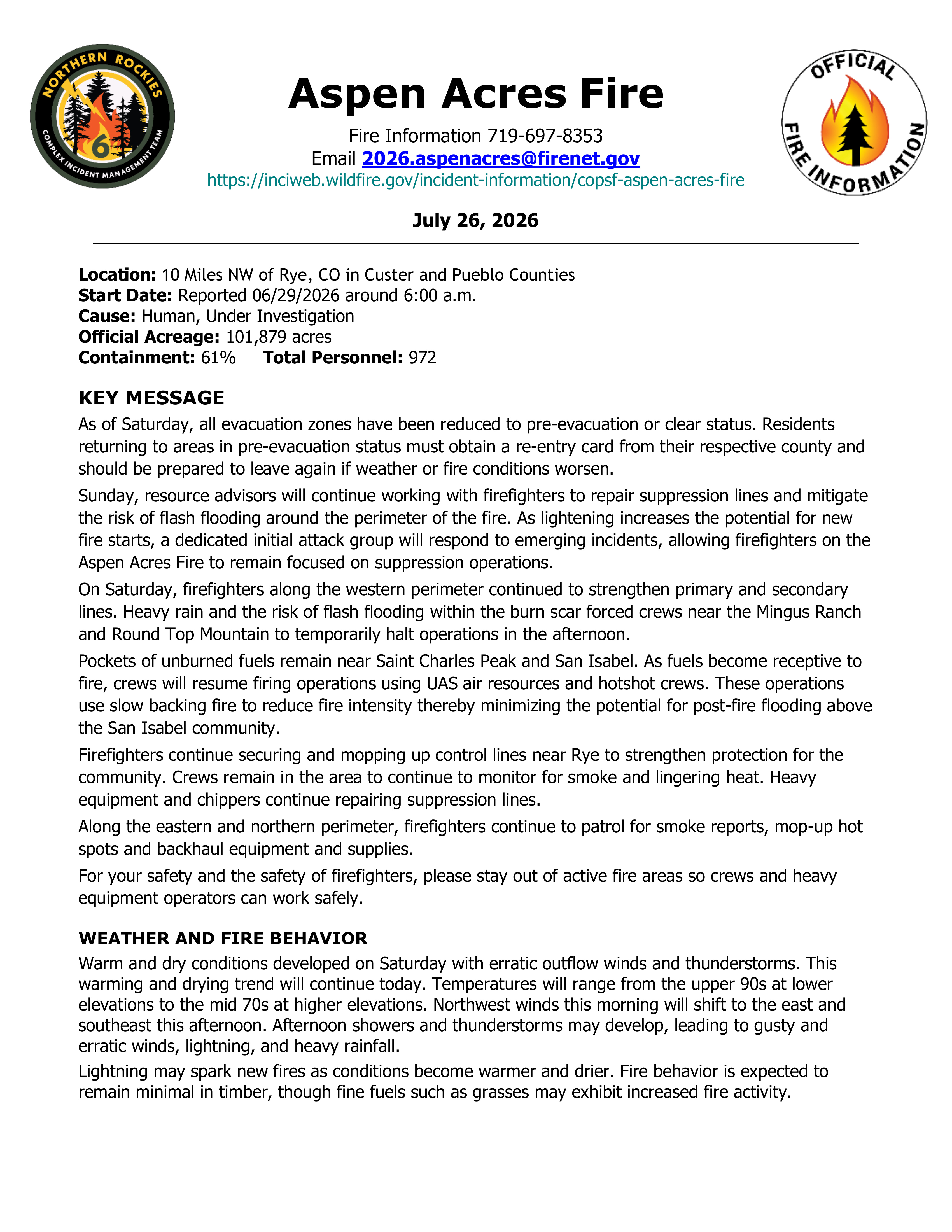
Daily Update for Aspen Acres Fire 07/26/2026
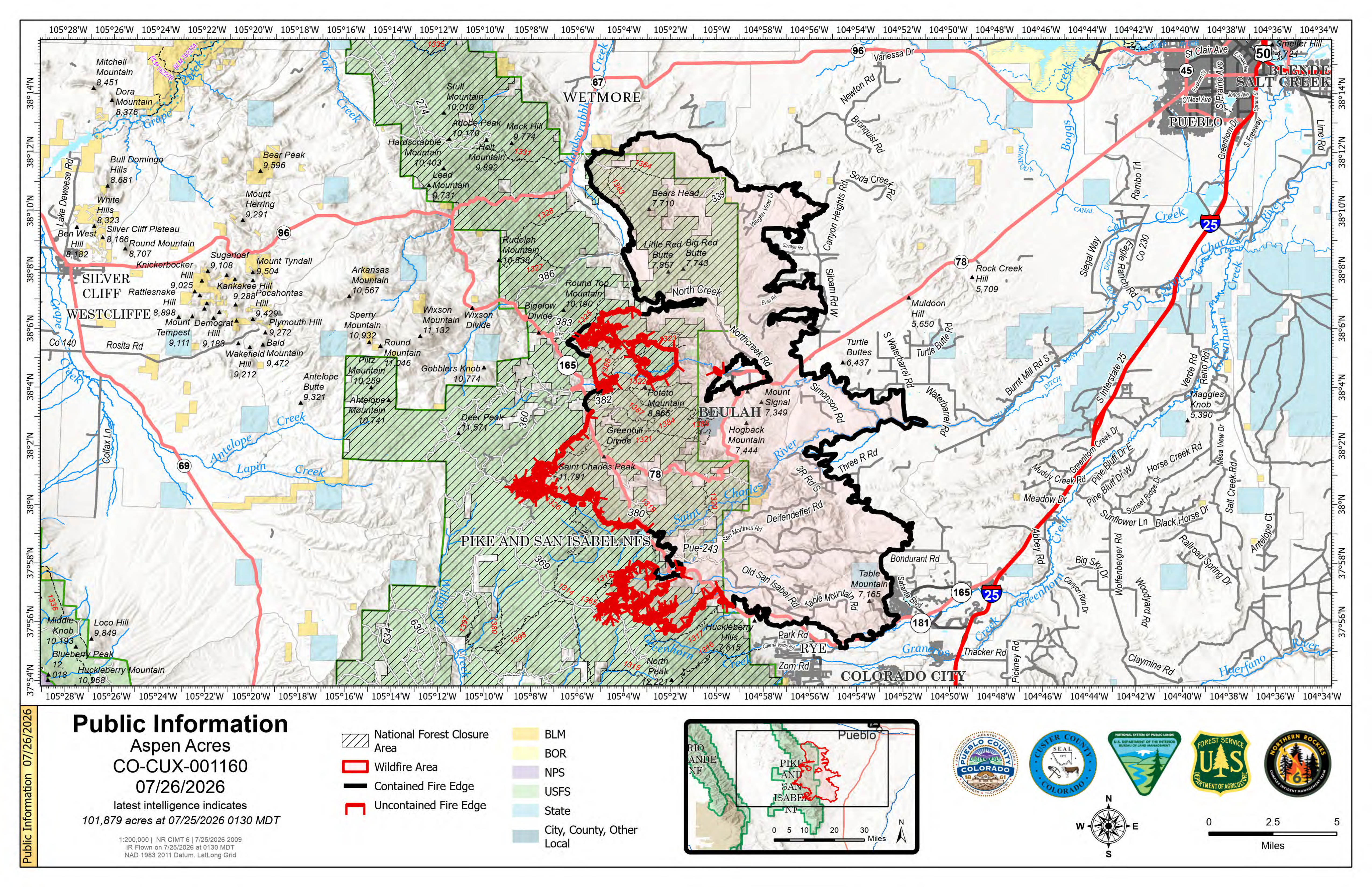
Location: 10 Miles NW of Rye, CO in Custer and Pueblo Counties
Start Date: Reported 06/29/2026 around 6:00 a.m.
Cause: Human, Under Investigation
Official Acreage: 101,879 acres
Containment: 61% Total Personnel: 972
KEY MESSAGE
As of Saturday, all evacuation zones have been reduced to pre-evacuation or clear status. Residents returning to areas in pre-evacuation status must obtain a re-entry card from their respective county and should be prepared to leave again if weather or fire conditions worsen.
Sunday, resource advisors will continue working with firefighters to repair suppression lines and mitigate the risk of flash flooding around the perimeter of the fire. As lightening increases the potential for new fire starts, a dedicated initial attack group will respond to emerging incidents, allowing firefighters on the Aspen Acres Fire to remain focused on suppression operations.
On Saturday, firefighters along the western perimeter continued to strengthen primary and secondary lines. Heavy rain and the risk of flash flooding within the burn scar forced crews near the Mingus Ranch and Round Top Mountain to temporarily halt operations in the afternoon.
Pockets of unburned fuels remain near Saint Charles Peak and San Isabel. As fuels become receptive to fire, crews will resume firing operations using UAS air resources and hotshot crews. These operations use slow backing fire to reduce fire intensity thereby minimizing the potential for post-fire flooding above the San Isabel community.
Firefighters continue securing and mopping up control lines near Rye to strengthen protection for the community. Crews remain in the area to continue to monitor for smoke and lingering heat. Heavy equipment and chippers continue repairing suppression lines.
Along the eastern and northern perimeter, firefighters continue to patrol for smoke reports, mop-up hot spots and backhaul equipment and supplies.
For your safety and the safety of firefighters, please stay out of active fire areas so crews and heavy equipment operators can work safely.
WEATHER AND FIRE BEHAVIOR
Warm and dry conditions developed on Saturday with erratic outflow winds and thunderstorms. This warming and drying trend will continue today. Temperatures will range from the upper 90s at lower elevations to the mid 70s at higher elevations. Northwest winds this morning will shift to the east and southeast this afternoon. Afternoon showers and thunderstorms may develop, leading to gusty and erratic winds, lightning, and heavy rainfall.
Lightning may spark new fires as conditions become warmer and drier. Fire behavior is expected to remain minimal in timber, though fine fuels such as grasses may exhibit increased fire activity.
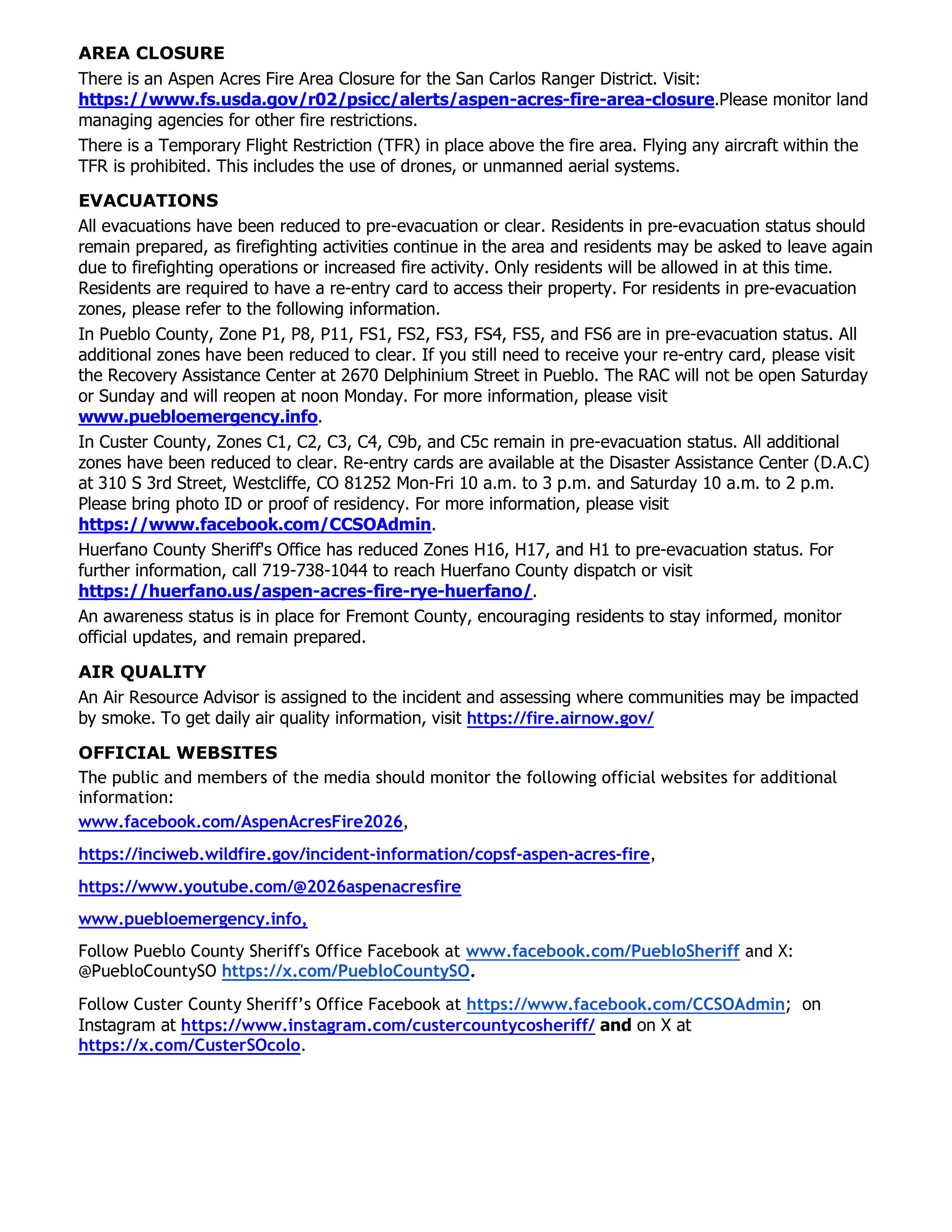
AREA CLOSURE
There is an Aspen Acres Fire Area Closure for the San Carlos Ranger District. Visit: https://www.fs.usda.gov/r02/psicc/alerts/aspen-acres-fire-area-closure.Please monitor land managing agencies for other fire restrictions.
There is a Temporary Flight Restriction (TFR) in place above the fire area. Flying any aircraft within the TFR is prohibited. This includes the use of drones, or unmanned aerial systems.
EVACUATIONS
All evacuations have been reduced to pre-evacuation or clear. Residents in pre-evacuation status should remain prepared, as firefighting activities continue in the area and residents may be asked to leave again due to firefighting operations or increased fire activity. Only residents will be allowed in at this time. Residents are required to have a re-entry card to access their property. For residents in pre-evacuation zones, please refer to the following information.
In Pueblo County, Zone P1, P8, P11, FS1, FS2, FS3, FS4, FS5, and FS6 are in pre-evacuation status. All additional zones have been reduced to clear. If you still need to receive your re-entry card, please visit the Recovery Assistance Center at 2670 Delphinium Street in Pueblo. The RAC will not be open Saturday or Sunday and will reopen at noon Monday. For more information, please visit www.puebloemergency.info.
In Custer County, Zones C1, C2, C3, C4, C9b, and C5c remain in pre-evacuation status. All additional zones have been reduced to clear. Re-entry cards are available at the Disaster Assistance Center (D.A.C) at 310 S 3rd Street, Westcliffe, CO 81252 Mon-Fri 10 a.m. to 3 p.m. and Saturday 10 a.m. to 2 p.m. Please bring photo ID or proof of residency. For more information, please visit https://www.facebook.com/CCSOAdmin.
Huerfano County Sheriff's Office has reduced Zones H16, H17, and H1 to pre-evacuation status. For further information, call 719-738-1044 to reach Huerfano County dispatch or visit https://huerfano.us/aspen-acres-fire-rye-huerfano/.
An awareness status is in place for Fremont County, encouraging residents to stay informed, monitor official updates, and remain prepared.
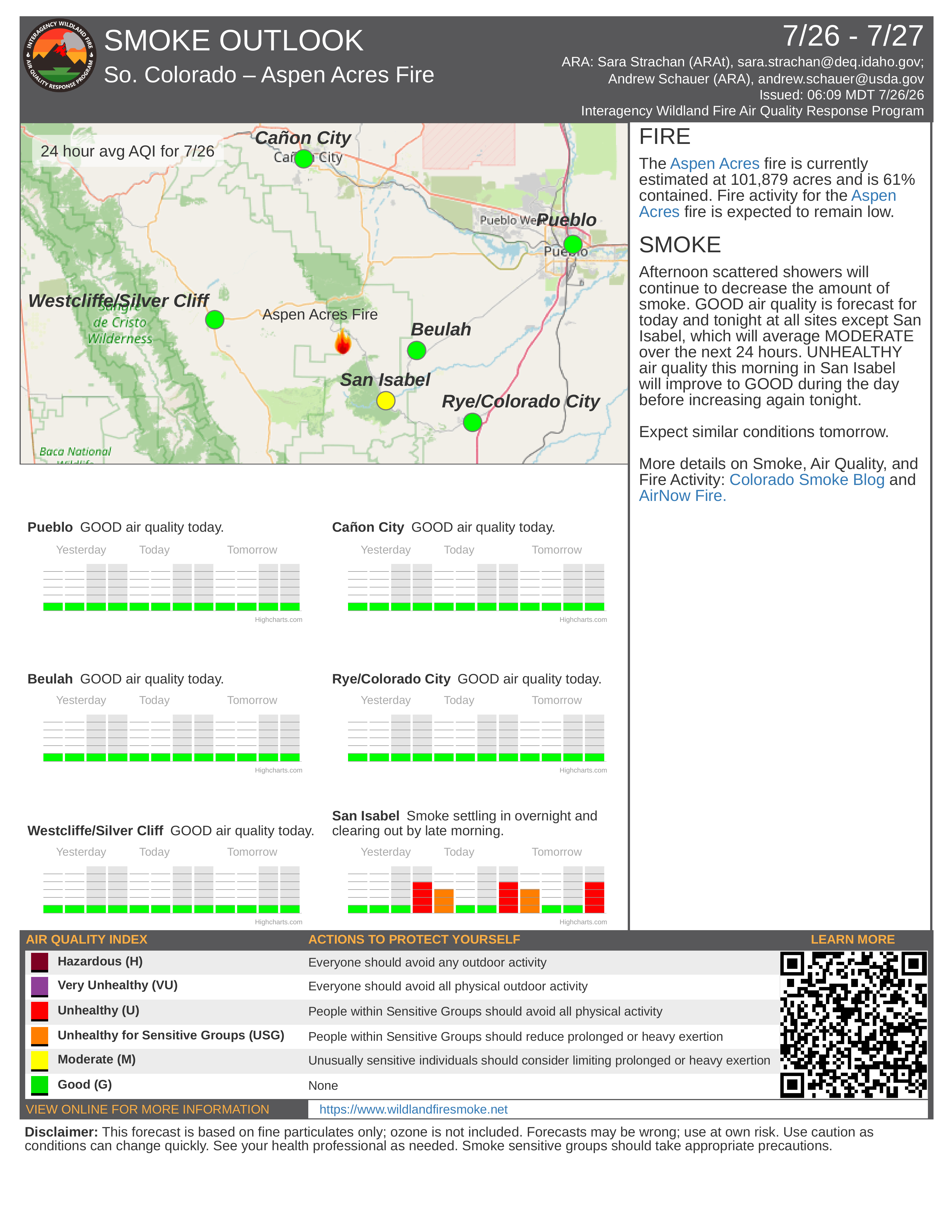
AIR QUALITY
An Air Resource Advisor is assigned to the incident and assessing where communities may be impacted by smoke. To get daily air quality information, visit https://fire.airnow.gov/
OFFICIAL WEBSITES
The public and members of the media should monitor the following official websites for additional information:
Follow Pueblo County Sheriff's Office Facebook at www.facebook.com/PuebloSheriff and X: @PuebloCountySO https://x.com/PuebloCountySO.
Follow Custer County Sheriff's Office Facebook at https://www.facebook.com/CCSOAdmin; on Instagram at https://www.instagram.com/custercountycosheriff/ and on X at https://x.com/CusterSOcolo.

Image Gallery